Map of France

La Lande-Saint-Léger photos


Find a town, a zip code,
a department, a region... in France
I like Map-France.com !


La Lande-Saint-Léger pictures


Here are the photos of the town of La Lande-Saint-Léger and nearby towns. La Lande-Saint-Léger is located in the department of Eure in the region of Haute-Normandie. You will find the satellite map of La Lande-Saint-Léger under these photos.

To see photos of nearby towns of La Lande-Saint-Léger, you can try the following links :
   - Photos of Le Bois-Hellain (27260) : town located at 2.92 km
   - Photos of Martainville (27210) : town located at 3.17 km
   - Photos of Bonneville-la-Louvet (14130) : town located at 3.28 km
   - Photos of Le Torpt (27210) : town located at 3.86 km
   - Photos of La Chapelle-Bayvel (27260) : town located at 4.13 km
   - Photos of Vannecrocq (27210) : town located at 4.55 km
   - Photos of Beuzeville (27210) : town located at 5.29 km
   - Photos of Les Authieux-sur-Calonne (14130) : town located at 5.62 km
   - Photos of Fort-Moville (27210) : town located at 5.64 km
   - Photos of Cormeilles (27260) : town located at 5.72 km
   - Photos of Quetteville (14130) : town located at 5.95 km
   - Photos of Épaignes (27260) : town located at 5.99 km

 - photos of the department prefecture of Eure : photos of Évreux
 - pictures of others cities of Eure : Eure


To see La Lande-Saint-Léger from the sky, here is the satellite map of the town of La Lande-Saint-Léger : La Lande-Saint-Léger map.

I like La Lande-Saint-Léger !


Photos of the town of La Lande-Saint-Léger

These photos taken near the town of La Lande-Saint-Léger can be shown in full screen clicking on the thumbnails. Photos are copyrighted by their owners.

Church at Courmeilles. The inside goes uphill to the altar! - Photo of La Lande-Saint-Léger
Church at Courmeilles. The inside goes uphill to the altar!

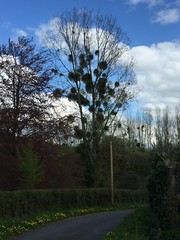
Mistletoe - Photo of La Lande-Saint-Léger
Mistletoe

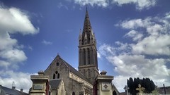
Église Langrune-sur-mer - Photo of La Lande-Saint-Léger
Église Langrune-sur-mer

Langrune-sur-mer - Photo of La Lande-Saint-Léger
Langrune-sur-mer

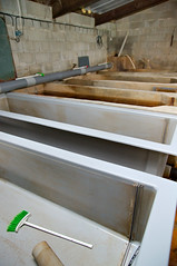
Bassins de la pisciculture de la Calonne - Photo of La Lande-Saint-Léger
Bassins de la pisciculture de la Calonne

Nourrisseur - Photo of La Lande-Saint-Léger
Nourrisseur

Aérateur en action - Photo of La Lande-Saint-Léger
Aérateur en action

Bassin de la pisciculture de la Calonne - Photo of La Lande-Saint-Léger
Bassin de la pisciculture de la Calonne

Écloserie - Photo of La Lande-Saint-Léger
Écloserie

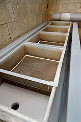
Bassins et bacs de l’écloserie - Photo of La Lande-Saint-Léger
Bassins et bacs de l’écloserie

Bassin de l’écloserie - Photo of La Lande-Saint-Léger
Bassin de l’écloserie

Écloserie - Photo of La Lande-Saint-Léger
Écloserie

Truites d’élevage - Photo of La Lande-Saint-Léger
Truites d’élevage

Distributeur de granulés - Photo of La Lande-Saint-Léger
Distributeur de granulés


La Lande-Saint-Léger from the sky


Old photos of the town of La Lande-Saint-Léger

These photos taken near the town of La Lande-Saint-Léger can be shown in full screen clicking on the thumbnails. Photos are copyrighted by their owners.


Other maps, hotels and towns in france


Find another town, zip code, department, region, ...


Quick links La Lande-Saint-Léger :


Back to the menus Map of France :


Make a link to this page of La Lande-Saint-Léger with the following code :


Map of France | Regions | Departments | Cities | Partners | Terms | Contact